| Sign In | Join Free | My futurenowinc.com |
|
| Sign In | Join Free | My futurenowinc.com |
|
| Categories | Geophysical Exploration Instrument |
|---|---|
| Brand Name: | GOLD |
| Model Number: | WGMD-9 |
| Certification: | CE, ISO |
| Place of Origin: | chongqing,China |
| MOQ: | 1 set |
| Price: | Negotiated |
| Payment Terms: | L/C,D/A,D/P,T/T,Western Union |
| Supply Ability: | 1 set per 5 days |
| Delivery Time: | 5-8 work days |
| Packaging Details: | wooden case |
| Product name: | super electric multi-electrode Survey system |
| Brand name: | GOLD |
| Place of origin: | Chongqing, China |
| Host machine: | WDA-1 |
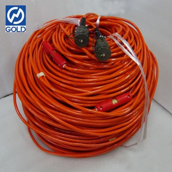
| Cable: | 5m space cable, 10m space cable(optional) |
| Maximum power: | 7200W |
| Maximum supply voltage: | ±1200V |
| Working temperature: | -10℃~+50℃, 95%RH |
| Company Info. |
| Chongqing Gold Mechanical & Electrical Equipment Co.,Ltd |
| Verified Supplier |
| View Contact Details |
| Product List |
Mapping the Subsurface Commons: WGMD-4 for Strategic Resource Security
The Subsurface as a Critical Strategic Domain
Water, minerals, and stable ground are not merely commodities; they
are strategic resources fundamental to national and economic security. The WGMD-4 Strategic Resource Mapping System provides governments, municipalities, and corporations with the
capability to inventory, monitor, and manage these hidden assets with ±1% audit-grade precision. It transforms the subsurface from a vague, contested space into a
charted, quantifiable, and manageable strategic reserve. Whether securing a city's water future, validating national
mineral reserves, or safeguarding infrastructure from geological
hazards, the WGMD-4 provides the definitive map of what lies
beneath, enabling long-term, evidence-based resource governance.

Quantification as the First Step to Stewardship
You cannot manage what you do not measure. The first and most
critical step in responsible resource stewardship is accurate volumetric quantification. The WGMD-4 answers this need with unmatched precision. For water resources, it doesn't just find water; it delineates the aquifer geometry, estimates total storage volume,
and characterizes hydraulic properties with ±1% confidence, moving beyond "there is water" to "there are 4.2 million cubic
meters of extractable water in this defined reservoir." This level
of certainty is the bedrock of sustainable extraction licenses,
transboundary water agreements, and climate resilience planning.
Five Strategic Resource Management Applications
National Aquifer Atlas Development:
The WGMD-4 is the ideal tool for systematic, national-scale
groundwater mapping. Its 900V deep-sensing capability can profile major basin aquifers, while its ±1% accuracy ensures the resulting atlas is a reliable legal and planning
document. This forms the basis for sustainable yield policies, drought contingency plans, and protection of critical recharge
zones.
Strategic Mineral Reserve Verification:
Beyond initial exploration, the WGMD-4 provides the detailed 3D delineation needed to move from a mineral "resource" to a provable mineral
"reserve." Its ability to differentiate ore grades and map deposit
geometry with high accuracy supports bankable feasibility studies,
secures project financing, and ensures accurate royalty reporting.
Urban Resource and Risk Inventory:
For cities, the subsurface is a crowded space of pipes, cables,
tunnels, and natural features. The WGMD-4 helps create a unified subsurface utility and geology map (SUGM). This "subsurface cadaster" is essential for avoiding utility
strikes, planning urban densification, managing groundwater under
cities, and identifying areas at risk from subsidence or
liquefaction.
Critical Infrastructure Geosecurity:
Airports, dams, power plants, and data centers require absolute
ground stability. The WGMD-4 performs high-resolution health scans of the foundation geology for such assets. It can detect subtle
changes over time—like progressive weathering or seepage—that may
indicate emerging risks, enabling pre-emptive maintenance and
protecting critical national infrastructure.
Environmental Liability Assessment and Monitoring:
For legacy industrial sites or mining areas, the WGMD-4 quantifies the environmental liability. It maps the extent of contamination plumes and monitors the
effectiveness of containment or remediation measures over decades.
This provides a clear, auditable record for regulatory compliance,
corporate reporting, and transactions (mergers, sales, insurance).


Strategic Resource Assessment Specifications
| Management Metric | System Assurance for Governance |
|---|---|
| Volumetric Accuracy | ±6V calibrated system delivering ±5‰ volumetric precision |
| Wide-Area Survey Capability | 5A high-efficiency transmitter for rapid coverage of large strategic areas |
| Data Integrity for Policy | ≥50MΩ pristine signal acquisition ensuring >80dB political-grade data clarity |
| Deep Resource Assessment | 900V strategic depth penetration for profiling continental aquifers & deep mineral zones |
| Adaptive National Survey Protocols | 12+ standardized array methodologies endorsed for resource inventory work |
| Sovereign-Grade Reliability | IP68 mil-spec durability for deployment in any territory or climate |
Informing Policy, Law, and Investment
Data from the WGMD-4 carries the weight needed to inform
high-stakes decisions. Its ±1% accuracy makes it admissible in legal settings for resolving water rights
disputes or mineral claim conflicts. For policymakers, it provides
the objective evidence needed to draft effective land-use plans, environmental protection
zones, and resource taxation frameworks. For investors and
financial institutions, a resource assessment backed by WGMD-4 data
represents a de-risked asset, as it reduces the "resource uncertainty" premium and provides
confidence in the underlying value of the investment.
Building Resilience through Knowledge
In a world facing climate change and resource scarcity, resilience
is rooted in knowledge. The comprehensive subsurface intelligence
provided by the WGMD-4 allows societies to build resilience proactively. A city that knows its aquifer storage and recharge rates can plan
for multi-year droughts. A nation that has accurately mapped its
mineral wealth can develop strategic industries. A region that
understands its fault lines and landslide risks can build safer
communities. The WGMD-4, therefore, is more than a tool for today's
project; it is an investment in the long-term security, sustainability, and strategic
foresight of an organization, a city, or a nation. It ensures that decisions about the most fundamental
resources—those hidden beneath our feet—are made with clarity,
confidence, and a long-term vision for stewardship.


|
